Run creatively by Deben Climate Centre, this day long workshop was with a rich and diverse collection of people involved or living beside the Blyth River. Typically farmers and landowners, the Blyth Farming Cluster, Anglia Water, Environment Agency, Blyth Valley Church, Wilder Wenhaston, Parish and Town Councillors (eg Halesworth and Huntingfield) and including Halesworth ASH. Here is a brief report recorded by Rachel
Deben Climate Centre: Eamonn O’Nolan, Siobhan Horner-Galvin, workshop well run by Andy.Project funded by East Suffolk County Council, started 2022.
Main hurdles: all rivers in a bad shape, share many of the same causes, various individual groups already working on separate areas. Project collaborative and supportive and funded.
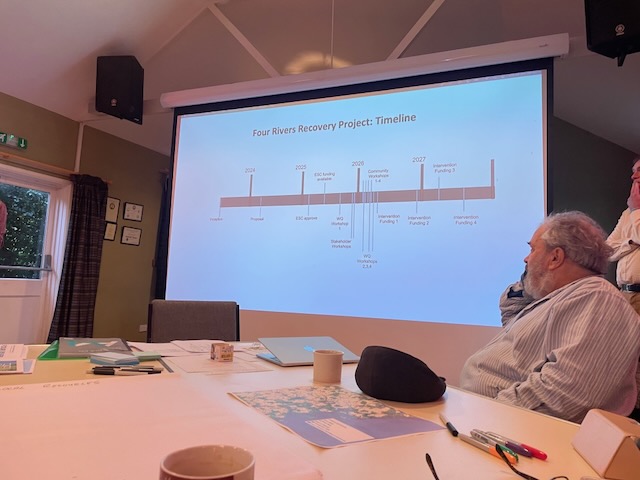
Three stages: 1. WORKSHOP 2. CITIZEN SCIENCE 3. IMPLEMENTATION. We are at Workshop stage, with each River system having its own workshop.
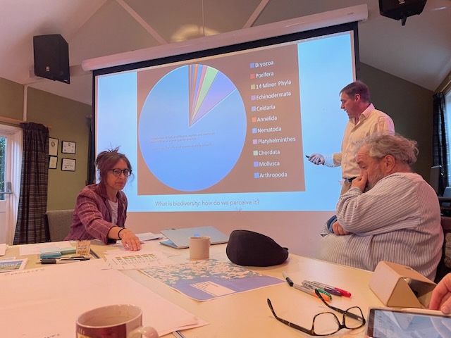
Andy – his own background is in his home being flooded. Signpost to Atlas of Living Australia – a collaborative, digital, open infrastructure that pulls together Australian biodiversity data from multiple sources, making it accessible and reusable. Relevance of vital role of Citizen Science.
Vision is a healthy river system with a good water quality that supports thriving biodiversity, provides safe spaces for wildlife and people, and brings environmental prosperity through natural flood management and minimal pollution.
MATERIAL / ENVIRONMENTAL REGULATION / FUNDING / CULTURAL WELL-BEING
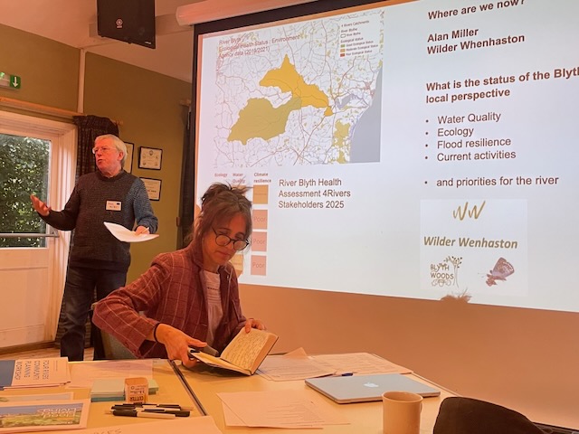
Alan Miller outlined the main threats to the Blyth River
- Sewage outflow from Treatment plants and Septic Tanks. Not just during exceptional rainfall, so evidence mainly that it’s caused by over population and a system not fit for purpose. Outdated
- Soil degradation
- Sluice at Blythburgh
- Himalyan Balsam eg Bramfield and Halesworth areas, which causes errosion and through its dominance, threatens biodiversity of natural
Anglia Water: admitted failings. (I won’t take offence, I will take note) Historically priority to keep the bills low, not enough maintenance.
Environment Agency: We in UK one of the largest users of water. 120 Liters per person per day, more than Italy. . Our products have increased in chemistry. Awareness has increased.
CYCLE: Flood Drought
Intervention
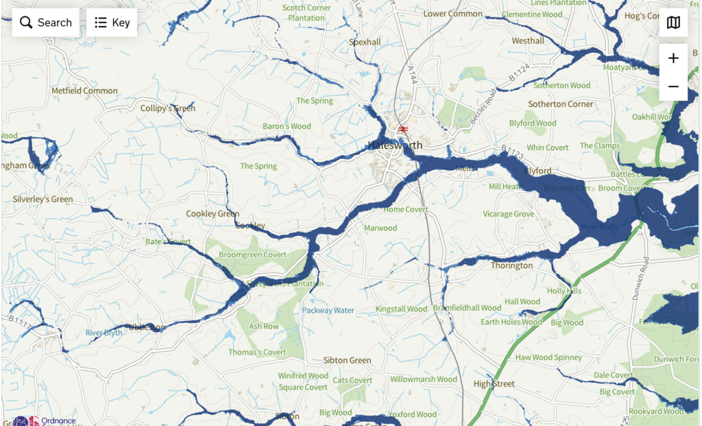
Catchment based solutions. Slow the flow, extend the flood, gravel the ground to replenish ground water acquifers, use water more prudently, use water butts, not wet wipes. Flood mapping UK
Scoping (Riparian owners, stakeholders)
Mapping
Management
Linking
Task
Implementation
The MATRIX What was the most /least urgent? What was the most /least challenging? What the most difficult/easiest to implement? What was the cost? Over how many years?
Easiest and most effective solutions to implement discussed in our group.
- Woodland/Hedgerow corridors -= joining up the work that already exists eg Wissett corridor, Wenhaston, and Halesworth corridors
- Mapping CSO Outfall safari, of Sewage Treatment plants (Political)
- Flood plain – Broadwalks, awareness, love of water meadows
- Water usage – awareness campaign. Can we lever with competition? Compare Wenhaston with Westall? Encourage water butts. Grey water recycling for toilet flush
- Stories – linking people with their rivers. Walks, Pilgrimages, heritage tree walks, involve potters (clay) artists, poets
- Himalayan Balsam – needs to be co-ordinated. We have a relatively small rivers system. Already groups working, However needs to be a 5 year min project . Utilising local organisations.
Summary of workshop